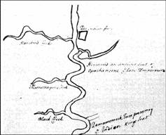
1662 Langston
Anthony Langstroms map
definitively locates Opechancanoes head
quarters as “The Island.”
The map was filed away
in England without a date and author. In 1984, Martha
McCartney identifies the author and date through
handwriting analysis.
“Menmend an ancient Seat of Opachancone
[Opechancanough] ye late Emperour”