
Scale was the basis for confusion
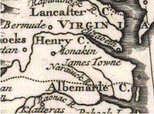

In 1726 John Kerr labels the Manakin as living just West of Jamestowne. They drew the S different in the 1700s, and this increased the confusion making “Manakin” and Manskin” look very similar. This is an issue of scale. In the maps showing larger areas, the Manakin are shown in this area, and in small scale it is the Manskin.


1719 John Senex


1726 John Kerr