
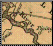
1671
John Lederer


This circle is a consistent cartographic
representation of “the Island,” Although it more closely resembles the Langstrom Map being to the side rather than in the middle of the river as in the
1700’s Fry series.


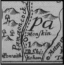
1751 Fry
1781 Chesnoy
1755 Vaugondy

1662
Langstrom


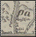
I did find a different versions of the
same Lederer Map, and in this
one the circle has a dot inside similar to other Indian Village designation on the map.

