
1671
Nova Virginiae Tabula
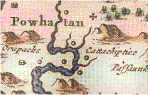


Clearly a copy of the John Smith map, but with a change.
Nova Virginiae Tabula has the middle village as Cattachiptico. Dropping the name lower indicates the village is between Pampatike Creek and Piping Tree Creek now called the
“Pampatike River
Field.”
Smith has this west most village as Cattachiptico
He aligns the name with the village between Monquin and Pampatike Creek. If you draw a line under the village and the name they align.